
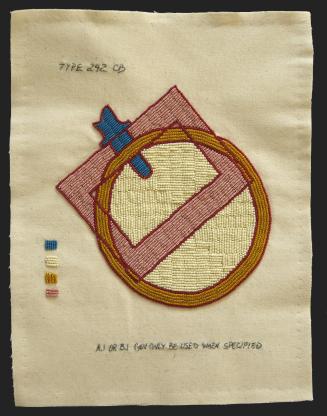
Cultural Laminae
Artist
Scott Schuldt
MediumRoofing gauge copper, gesso, plywood, wax
Dimensions28 x 49 in. (71.1 x 124.5 cm)
ClassificationsMixed Media
Credit LineSeattle Public Utilities 1% for Art Portable Works Collection
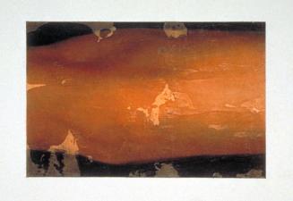
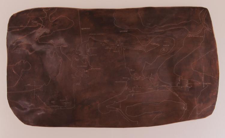
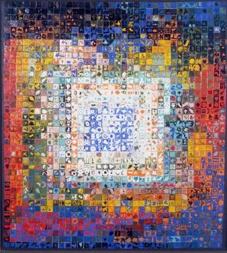
The copper map panel, although accurate, is unlike most maps in that it is not fixed in time. Cultural laminae rarely exist as homogenous entities; rather there are sometimes clear and sometimes obscure boundaries, mergings and connections. So, this map blends modern and past features as some of the map is modern and some of it is ancient. It unearths previous cultural markers and leaves out some modern objects. In fact, the map is a result of my own exploration of the area and it is built with a combination of technologies ranging from rough estimation to a canoe based survey with an alidade and plane table, archived public utility maps and finally, GPS systems and satellite photography. In the center of the map is Union Bay with Lake Washington at the bottom edge. Union Bay has long been inhabited by man and continually undergoes man-made modifications. It is, to twist archaeology phrasing, a “culturally modified bay”. It also appears to be one of the most natural areas in Seattle even though it has been extensively changed from its natural state. The bay seems to me to be bound and determined to return to a natural state. Exploring the map, one will find approximate locations of Duwamish long houses, an ancient portage, my modern canoe portage, a burial ground, wildlife sites, fragments of the storm water sewer system, a shopping mall, and a totem pole that is, culturally, hundreds of miles out of place. One will also notice that some modern features such as buildings, the Montlake cut and SR 520 are not present. Patina’d copper was used for several reasons. It is significant as man’s first step out of a paleolithic era. The simple stamping technique is not dissimilar to that used in making petroglyphs. Finally, the uneven color of the map is quite reminiscent of the exposed surface in an archaeologist’s excavation. The irregular shape of this map suggests that the edges are not limitations or boundaries and that there is more beyond what you can see. –Artist statement
Map Features
Shoreline and 25 meter contours are shown in simple dot punches.
Two portage routes are marked with circular punches
Upper Left – “Portage” This is one of my portage routes that I use to move my canoe from my house to the water. This route was recorded using GPS. UTM grid coordinates are stamped in for a three points.
Center top – The ancient Duwamish portage route from Union Bay to Portage Bay. One of the most culturally laminated spots on the map. It became a log flume in the late 19th century. SR 520 lies on top of it now.
Storm water system – Parts of the Seattle storm water sewer system is shown in dashed lines with notation at to pipe diameters. The information was taken from sewer cards in the Seattle map archive, so some of the data may be obsolete. One can derive some information about the lay of the land by examining storm water systems. Pipes increase in diameter as one goes downhill. In some cases, pipes have replaced creeks or ravines.
Longhouses – Three approximate locations for Duwamish longhouses are labeled. Two other longhouses are unmarked as I could not guess at their locations due to sketchy descriptions and significant changes to the shoreline. Near one longhouse, the word “potlatch” denotes the possible location of a potlatch structure.
Burial Island – Foster Island is relabeled “Burial Island”. The highest portions of the modern island were used for tree burials by the Duwamish. The Duwamish called the island, Stitici, which means Little Island. The island is no longer little. Burial Island makes more sense to me as a name.
The McGilvra Colony – The Seattle Archives has an undated map of the McGilvra Colony, which was apparently falling into disrepair when the map was made.
East Marsh, North Marsh – again, my names for land features. East Marsh is actually east of the burial island. The north marsh is a significant collector of floating debris.
Culturally Modified Tree – This is the Haida Totem Pole standing on the south side of the Montlake Cut. Culturally, it is several hundred miles out of place and after spending so much time becoming acquainted with the bay, I found it confusing to deal with, especially since there are no indications, anywhere, that this was once Duwamish territory. So, I gave it a sterilized archaeology label.
Bathtubs – there are at least three old bathtubs here. You can see them clearly when the lake is low and clear in the winter. There are other bathroom fixtures nearby. It’s a bad place to swim or play with your dog.
Dead Sailboat – At low water one will find a sunken wood sailboat here.
Beaver Lodge – Five beaver lodges are marked. “The workbench” near one of the lodges is a small island that the beaver uses to strip bark. It looks like a wood shop workbench when the beaver has been busy.
Eagle Perches – Several eagle perches are marked. Some are used only at certain times of the year and are marked as such.
The Lunch Counter – This is a set of pilings where the eagles prefer to eat the coots that they catch during the winter months. They seem to eat closer to their nest at other times of the year.
“Where the water disappears” & “where the water reappears” – Ravenna Creek is in the upper right corner, flowing on the surface until it drops into a hole in the ground. It reappears after traveling under the University Village shopping mall.
Village Site – actually, University Village shopping mall. Two large grocery stores are marked “hunting and gathering”. “Pottery” marks another store, the name of which you might guess.
Cultural Disconnect – my hand surveyed map did not quite agree with the USGS map.
1974